The 2016 Google Earth Engine User Summit: Turning pixels into insights
September 19, 2016
Posted by Chris Herwig, Program Manager, Google Earth Engine
Quick links
"We are trying new methods [of flood modeling] in Earth Engine based on machine learning techniques which we think are cheaper, more scalable, and could exponentially drive down the cost of flood mapping and make it accessible to everyone."
-Beth Tellman, Arizona State University and Cloud to Street
Recently, Google headquarters hosted the Google Earth Engine User Summit 2016, a three-day hands-on technical workshop for scientists and students interested in using Google Earth Engine for planetary-scale cloud-based geospatial analysis. Earth Engine combines a multi-petabyte catalog of satellite imagery and geospatial datasets with a simple, yet powerful API backed by Google's cloud, which scientists and researchers use to detect, measure, and predict changes to the Earth's surface.
 |
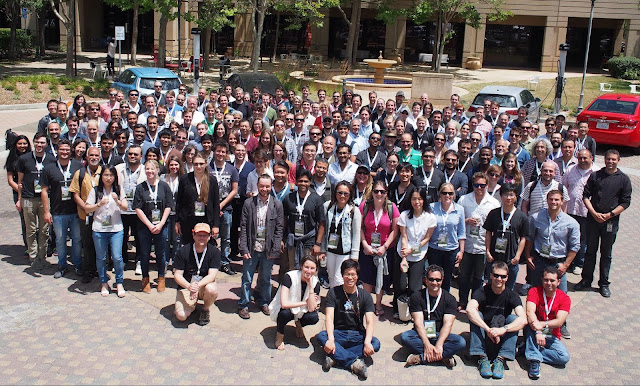
| Earth Engine founder Rebecca Moore kicking off the first day of the summit |
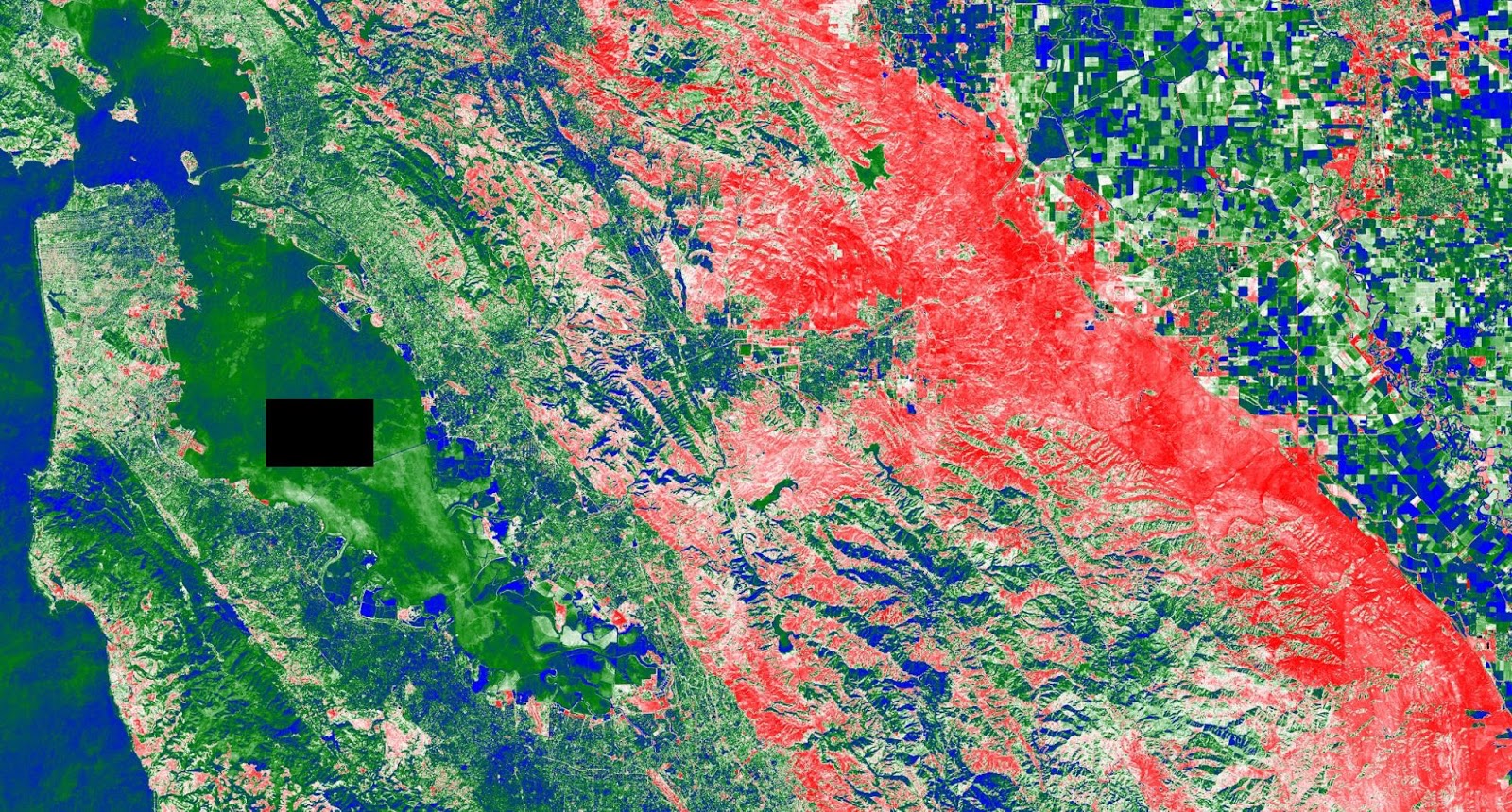 |
| Cross-correlation between Landsat 8 NDVI and the sum of CHIRPS precipitation. Red is high cross-correlation and blue is low. The gap in data is because CHIRPS is masked over water. |
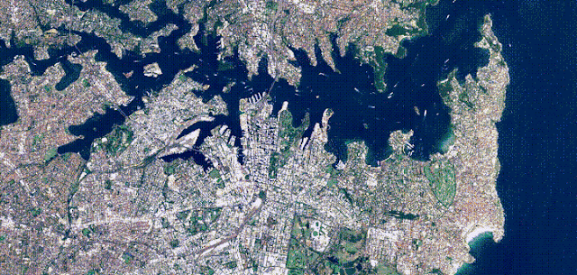
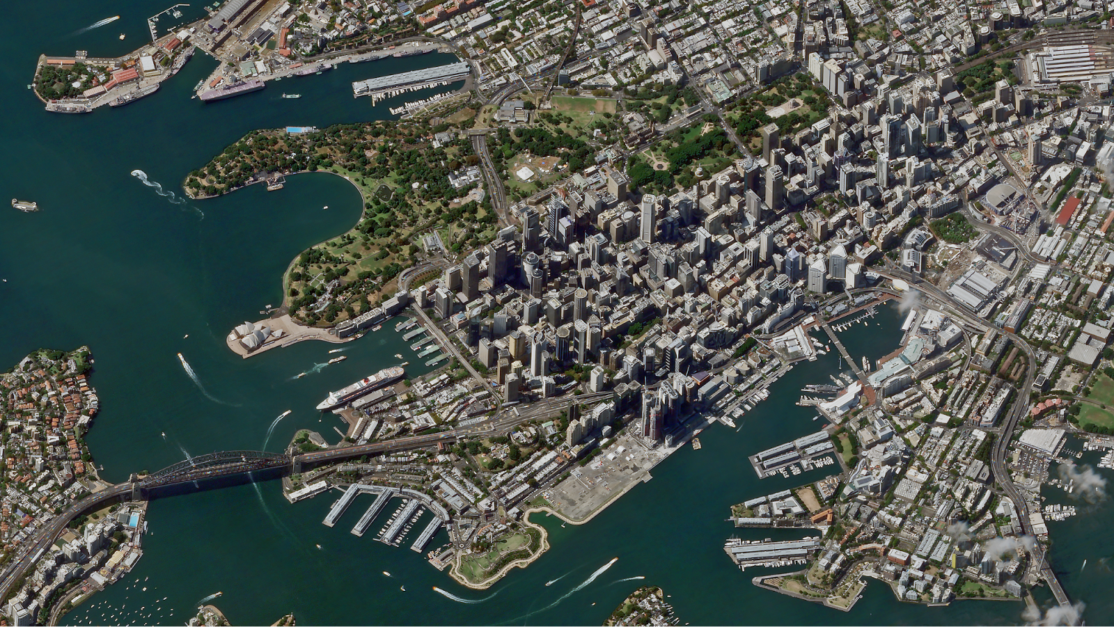
My workshop session covered how users can upload their own data into Earth Engine and the many different ways to take the results of their analyses with them, including rendering static map tiles hosted on Google Cloud Storage, exporting images, creating new assets, and even making movies, like this timelapse video of all the Sentinel 2A images captured over Sydney Australia.

Plenary Speakers
- Agriculture in the Sentinel era: scaling up with Earth Engine, Guido Lemoine, European Commission's Joint Research Centre
- Flood Vulnerability from the Cloud to the Street (and back!) powered by Google Earth Engine, Beth Tellman, Arizona State University and Cloud to Street
- Accelerating Rangeland Conservation, Brady Allred, University of Montana
- Monitoring Drought with Google Earth Engine: From Archives to Answers, Justin Huntington, Desert Research Institute / Western Regional Climate Center
- Automated methods for surface water detection, Gennadii Donchytes, Deltares
- Mapping the Behavior of Rivers, Alex Bryk, University of California, Berkeley
- Climate Data for Crisis and Health Applications, Pietro Ceccato, Columbia University
- Appalachian Communities at Risk, Matt Wasson, Jeff Deal, Appalachian Voices
- Water, Wildlife and Working Lands, Patrick Donnelly, U.S. Fish and Wildlife Service
- Stream-side NDVI and The Salmonid Population Viability Project, Kurt Fesenmyer, Trout Unlimited
- Mapping Evapotranspiration for Water Use and Availability, Mac Friedrichs, USGS
- Dynamic Wildfire Modeling in Earth Engine, Miranda Gray, Conservation Science Partners
- Fishing at Scale, now also in Earth Engine, David Kroodsma, Skytruth
- Mapping crop yields from field to national scales in Earth Engine, David Lobell, Stanford University
- Mapping Pacific Wildfires Impacts with Earth Engine, Matthew Lucas, University of Hawaii
- EarthEnv.org - Environmental layers for accessing status and trends in biodiversity, ecosystems and climate, Jeremy Malczyk, Map of Life
- Building a Landsat 8 Mosaic of Antarctica, Allen Pope, University of Colorado Boulder
- Monitoring Primary Production at Broad Spatial and Temporal Scales, Nathaniel Robinson, University of Montana
- Assessing Urbanization Trends for Public Health: Modelling Nighttime Lights Imagery in Africa with Earth Engine, David Savory, University of California, San Francisco
- National-scale mapping of forest carbon, Ty Wilson, US Forest Service
- Utilizing Google Earth Engine to Enhance Decision-Making Capabilities, Brittany Zajic, NASA DEVELOP National Program
It is always inspiring to see such a diverse group of people come together to celebrate, learn, and share all the amazing and wondrous things people are doing with Earth Engine. It is not only an opportunity for our users to learn the latest techniques; it is also a way for the Earth Engine team to experience the new and exciting ways people are harnessing Earth Engine to solve some of the most pressing environmental issues facing humanity.

Quick links
Other posts of interest
-

June 30, 2026
Introducing TabFM: A zero-shot foundation model for tabular data- Data Management ·
- Machine Intelligence ·
- Product
-

June 5, 2026
Unlocking dependable responses with Gemini Enterprise Agent Platform’s Agentic RAG- Data Management ·
- Machine Intelligence ·
- Natural Language Processing ·
- Product
-

January 13, 2026
Hard-braking events as indicators of road segment crash risk- Algorithms & Theory ·
- Product
×
❮
❯